Sunday, October 10, 2010
WINTER QUARTERS
We made the trip from Port Susan back to Lake Pleasant, our winter quarters. Gizmo is now a prisoner of the motor home as she can not wander freely here. It's the leash or nothing and she really REALLY does not like the leash. We are in a different spot this year because we now use our satellite dish and so we are in an area with better reception. Will post a picture or two later.
Sunday, September 12, 2010
I'm baaaack...
Well, I enjoyed a month or so (the only thing I count is treats) at our boat, Denita. I was happy to get back here to Port Susan however because I was concerned about the small critters getting out of control. I have been working hard to keep the population down which is something I don't have to do on the boat. Around there everything is way bigger then me.
So today I am frustrated because it is too wet outside for my little pink feet. I guess I will just have to sit it out here inside and watch the football game with the humans. Could be worse I suppose. We could be in the boat, crossing the Straits in a storm - been there, done that!
Gizmo
So today I am frustrated because it is too wet outside for my little pink feet. I guess I will just have to sit it out here inside and watch the football game with the humans. Could be worse I suppose. We could be in the boat, crossing the Straits in a storm - been there, done that!
Gizmo
Monday, September 6, 2010
SOME TIME WITH DENITA
Since the motor home needed to go in to the dealer for some repairs that were going to take a couple of weeks, we moved back onboard Denita and spent some time cruising Puget Sound like old times. Now we find ourselves having second thoughts about selling her.
 Sunset at Shilshole looking through the neighborhood.
Mount Ranier from Liberty Bay

The Seattle Skyline

The Dingy and the Zodiac
No, wait, I mean the Dingy and Arlyene
-----------------

While in Liberty Bay we spent a couple days with our old dock buddies Bob and Sherry Custer just before they departed on their dream trip to Mexico. Here we waive good bye and salute them with an air horn send off.
Friday, July 23, 2010
MOUNT ST. HELENS
We drove up to Mt St Helens today as a side trip from a gathering of folks who have the same brand of motor home as ours. The weather was perfect for the trip.
Like much of what we saw on our recent trip through the southwest, the scale of what happened and the resulting destruction is hard to convey in a photograph but we will try.
 The picture below is best viewed by clicking on it to enlarge. The Toutle River enters the picture in the lower left corner. It is a good sized river but hardly noticable in this photo. All the rest you can see that looks like river bed is actually ash and mud flow left over from the eruption over 30 years ago.
Below you can see the Toutle River as it winds its way through the mud flow. The mountain is in the background.

In the picture below the mud flow and ash averages 150 feet thick - and yes
that is still the Toutle River running through it. This is just below the crator.

...and here is the crator as it looks today with it's slowly rebuilding dome. This is taken from the Johnston Observatory.

Sunday, May 9, 2010
HOME AGAIN - PORT SUSAN


We made the trip from Cascade Locks, OR to the Tulalip Casino in good time in spite of accidents in Tacoma, Seattle, and Lynnwood on I-5. They cost us about 30-40 minutes overall. We "dry camped" here last night and had a nice dinner at a Casino restaurant. Today we will fuel up and take the coach to our lot in Port Susan and start some serious cleaning of both the coach and the truck, both are very dirty and still have a red tint to them from the fine red dust of Monument Valley and Moab. Overall we drove the coach 3500 miles and put an additional 500 on the truck doing side trips. Wherever we were we were "home". Both vehicles performed perfectly but, as expected, we shook a few things lose and the coach is going to be spending some time at the dealership getting a few things fixed. We may find ourselves living on Denita again for a few weeks. Oh Darn!
This has been in interesting spring for weather. It seems we were experiencing some kind of weather extreme almost everywhere except right here in the Pacific Northwest. We left in mild weather and came back to sunny skies. Eslewhere we had everything from high winds with gusts to 70 mph to freezing temperatures, snow and hail. One thing we did not have a lot of was rain. Having said that I must also say that every day we went out to explore we had good weather to do that. We hiked where and when we wanted to. The only thing that kept us from doing all the hikes we wanted to do was crowded parking lots with no place to park at the trail heads in Arches NP. We made up for that by going off road with the truck and finding a great hike with almost no one else around because the trail head was hard to get to withour a four wheel drive vehicle.
We enjoyed this adventure a great deal and look forward to planning our next one. This may be the last post for a while but I hope to add some pictures to this post and the last one and Arlyene is working on some video too.
WMD
Saturday, May 8, 2010
PENDLETON TO CASCADE LOCKS


 GREEN again!
Easy trip to Cascade Locks from Pendleton down the Columbia River gorge yesterday. It is nice to be around real trees again. After the last few weeks we can see how visitors are overwhelmed by the green of our area.
Had a "quiet" night replacing the wind with a train every now and then - a train going by about 150 yards from us. Hard to ignore. More of a problem for Arlyene then for the deaf guy. Will add some pictures later but getting on the road this morning hoping for a smooth ride through Seattle (hard to do on the washboard they call I-5) and back to Marysville where we will dry camp at the Tulalip Casino tonight. Then on to Port Susan on Sunday where the big clean up begins.
Had a "quiet" night replacing the wind with a train every now and then - a train going by about 150 yards from us. Hard to ignore. More of a problem for Arlyene then for the deaf guy. Will add some pictures later but getting on the road this morning hoping for a smooth ride through Seattle (hard to do on the washboard they call I-5) and back to Marysville where we will dry camp at the Tulalip Casino tonight. Then on to Port Susan on Sunday where the big clean up begins.
Thursday, May 6, 2010
WIND FALLS , ID TO PENDLETON, OR
 View 1 from Pendleton, OR KOA.
 View 2
 Gizmo on bird watch.
No, that title "Wind Falls" is not an error. That is my official renaming of Twin Falls, ID.
Good Grief Charley Brown! Wind, wind, and more wind. We drove in the wind the first half of today and finally got out of it more or less near the ID/OR border. We are currently settled in the KOA campground in Pendleton and will head for the Cascade Locks KOA in the Columbia river gorge tomorrow. Not much else to report except that Gizmo is doing an excellent job of being a traveling kitty and she manages to find time to also keep track of the local birds for us.
Wednesday, May 5, 2010
TWIN FALLS, ID
 Shoshone Falls
 Snake River Canyon below Shoshone Falls
 Rock Chuck
Not much to talk about as far as the 167 mile drive here from Brigham City, UT. Mostly flat and mostly windy. The later in the day the windier it gets. At one point on I-84 there were gates, like a railroad crossing, that they used to close the freeway during high winds and blowing snow.
As I write this about 5:30 local time it is very windy here and the sky has lots of dust in the clouds. Yesterday the forecast was for gusts to 45 mph. I think that is about what we are feeling here.
The KOA is actually in Jerome just outside Twin Falls so once we got settled I took the truck in to town and drove to Shoshone Falls. Oddly, all the local hype is about Shoshone Falls "The Niagara of the West" not Twin Falls. I likened it to Snoqualmie Falls but a bit wider. Being mid week and windy there were few people there. Few enough in fact that I was able to make friends with a "Rock Chuck" per the gate attendant. I had not seen one before. He said it is, "kind of like a Prairie Dog."
Expecting more wind tomorrow we hope to get an early start on our way to Pendleton, OR. Nothing to stick around here for that we can see except more wind.....
Tuesday, May 4, 2010
BRIGHAM CITY/GOLDEN SPIKE NATIONAL MONUMENT


We made it through Salt Lake City and north to Brigham City and had just enough time to jump in the truck and drive about 35 miles out to the site where the Golden Spike was driven at the completion of the Transcontential Railroad in 1869. I finished Steven Abrose's book about that about a month ago so this is something I wanted to see and I was disappointed only by the fact that we did not have more time to spend there. We got there at 4:15 and the National Monument closed at 5:00. Still, we were in time for the last "demonstration run" of the day with the real steam engine they operate there.
So these pictures account for most of today's excitement. Tomorrow we head for Twin Falls, ID hoping to get there early enough to see some sites.
Monday, May 3, 2010
'On The Road Again......"
 After all we have seen the trip today was pretty ho-hum. More red rock....
...a couple more canyons and cuts ......

...and then sthe surprise, a pretty nice KOA campground in Richfield, UT where it was sunny and warm with only a light breeze and real grass! That's Arlyene in her sun chair with the mountains in the background. Too bad we are only here overnight, then it is on to Bringham City, north of Salt Lake City. We are taking it easy and only doing, on average, a couple hundred miles a day. We are in no big hurry to get back. Nothing personal you understand.....
Sunday, May 2, 2010
LAST DAY AT ARCHES
 Down a long gravel road and up a sometimes steep sometimes dusty trail.....
 Then down through a valley surrounded by giants and around a corner. . .
 ... to visit yet another arch, this one hidden and reserved only for those willing to make the effort and enjoy the peace and quite of no crowds and no vehicles.
Today was our last day in Arches and all the parking lots for all the hikes we wanted to do were full. So it was off road for us and the reward was worth it. It was a good way to end the visit. Tomorrow we start the long grind home. We hear that Richfield, our next stop, has some views. I guess we will find out.
Saturday, May 1, 2010
CANYONLANDS NATIONAL PARK
 Just finished our trip to Canyonlands National Park with a side trip to Dead Horse State Park. This time I will just let the pictures do the talking. Tomorrow we head back to Arches to do some of the hikes we did not have time to do yesterday.
 Remember you can click on any picture to enlarge.


Friday, April 30, 2010
ARCHES NATIONAL PARK

 "Double Arch"
 "Balanced Rock"
 Most arches take a long time to form. This one formed instantly in 1940 when the middle fell out. I have pictures of the pieces on the ground below.
 Note the cars at the base in the foreground.
Arches NP is a lot more then arches but they are the formation that seems to be the most unique. There are lots of other formations here that would make the place special even without the arches. There is not a lot I can add to the pictures so I will just let them speak for themselves. I will only say that without the scale that having a person in the picture provides it is very hard to tell from a photograph how big some of these formations actually are.
Our plan is to go to Canyon Lands tomorrow and then come back here the next day to hike up close to some of the arches we missed today.
MOAB, UT


 The wind storm in Monument Valley was everything the National Weather Service promised, perhaps more. We ended up with fine red dust everywhere inside the coach. We will be cleaning that up for days finding it in new places. We drove up here to Moab yesterday in much calmer conditions although it hailed in Monument Valley before we left and we drove through a little more of it on the way here. The temperatures have been in the 40's and 50's so up to this point none of it has stuck on the roadway. We still have some higher elevations to cross on the way home so we are keeping our fingers crossed. It is supposed to start warming up in a few days.
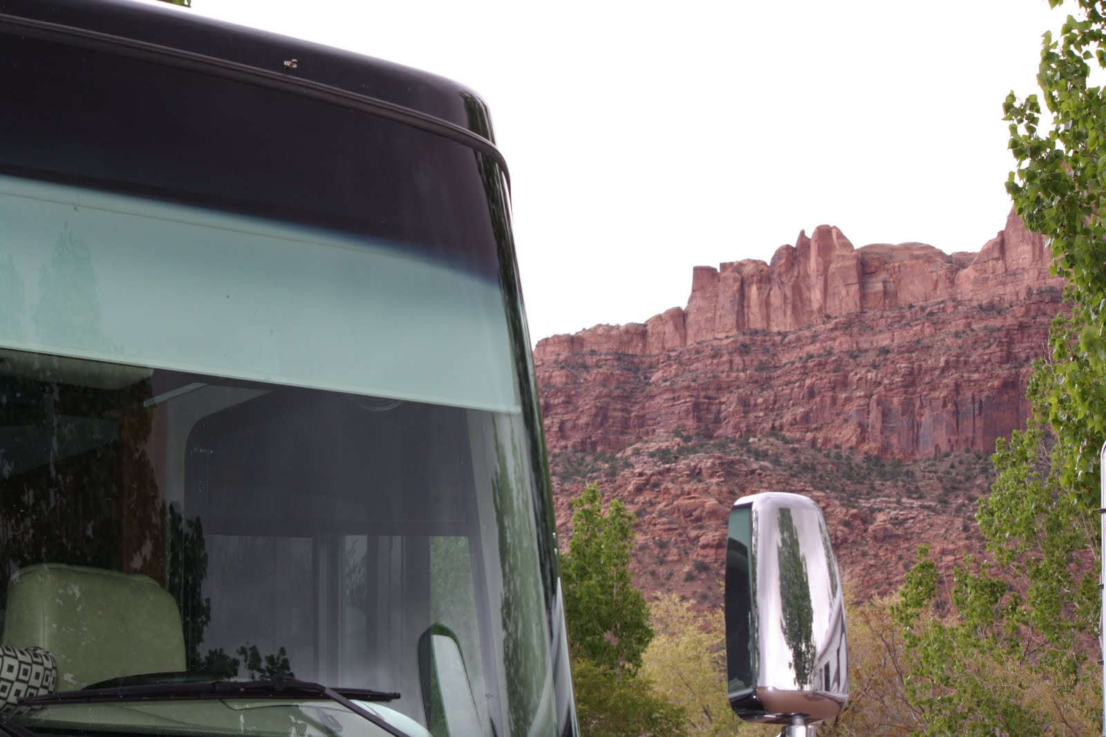
We have decided to alter our schedule once again and not only add back our lost day here in Moab but adding one more. That way we will be able to see more of this area. If you hike many of the trails and try to cover all there is to see in Arches and Canyon Lands NP's it could easily take a week or more. We'll do what we can in three days. We are headed for Arches NP today. More on that later. For now I am adding four pictures to this post. One of the dust storm and three more I took standing in front of the coach in our camping spot here in the Moab KOA.
Wednesday, April 28, 2010
LOOKS LIKE A "DOWN DAY"
This morning's NOAA weather forcast:
URGENT - WEATHER MESSAGESo I guess we will putter and maybe take some short trips in the truck today.
NATIONAL WEATHER SERVICE SALT LAKE
CITY
UT
612 AM MDT WED APR 28 2010
...HIGH WIND WARNING
REMAINS IN
EFFECT UNTIL NOON MDT TODAY...
A HIGH WIND WARNING REMAINS IN
EFFECT UNTIL
NOON MDT TODAY.
.
* WINDS: SUSTAINED WINDS OF 30 TO 40
MPH WITH GUSTS IN
EXCESS OF 55 MPH.
* TIMING: STRONG NORTHWEST
WINDS HAVE
DEVELOPED BEHIND A COLD FRONT. THE WINDS WILL GRADUALLY DECREASE THROUGH THE MORNING HOURS.
* IMPACTS: THE WINDS
WILL CAUSE TRAVEL
DIFFICULTIES FOR HIGH-PROFILE VEHICLES...ESPECIALLY ALONG
EAST-WEST ROUTES.
AREAS OF REDUCED VISIBILITIES IN BLOWING DUST CAN ALSO BE
EXPECTED. WIND
SENSITIVE OPERATIONS WILL LIKELY BE
AFFECTED.
PRECAUTIONARY/PREPAREDNESS ACTIONS...
A HIGH WIND
WARNING MEANS A HAZARDOUS HIGH WIND EVENT IS
EXPECTED OR OCCURRING.
SUSTAINED WIND SPEEDS OF AT LEAST 40 MPH OR
GUSTS OF 58 MPH OR MORE CAN LEAD
TO PROPERTY DAMAGE.
VEHICLES...ESPECIALLY HIGH PROFILE VEHICLES...CAN BE
DIFFICULT TO CONTROL
AT TIMES IN HIGH WINDS. MOTORISTS SHOULD TAKE EXTRA
CAUTION...
ESPECIALLY WHILE CROSSING BRIDGES...OVERPASSES AND
UNSHELTEREDAREAS
Tuesday, April 27, 2010
MONUMENT VALLEY


We were scheduled to stay here two nights before moving on to Moab, UT but a forecast for a serious storm with wind gusts in the 50 + mph range (one forcast said gusts to 70) caused us to change our plans and extend our stay here by one day. Not safe driving for what the National Weather Service calls "High Profile Vehicles" and we are one. We visited the valley this morning/afternoon and enjoyed very nice weather with just a mild, cooling breeze. One description of the valley....
Like the Grand Canyon the vast scale of this place and the size of the "Mounuments" make them not only hard to describe by words but it is also difficult to do them justice with photographs. We will hopefully be able to follow up this text with a few of the many we have taken. Since we will have a whole extra unplanned day here, probably hunkered down in the wind, cold and rain, we will certainly have the time if we can get the connection. We have had our share of wind on this trip - just part of spring I guess - but gusts in the 50 - 70 mph range really got my attention and we agreed to be safe rather then putting our beloved Norv Orbus in a ditch.
Monument Valley is a region of the Colorado Plateau characterized by a cluster of vast and iconic sandstone buttes, the largest reaching 1,000 ft (300 m) above the valley floor. It is located on the southern border of Utah with northern Arizona.It is hard to believe but the fossil records indicate that this used to be the bottom of the Gulf of Mexico!
Like the Grand Canyon the vast scale of this place and the size of the "Mounuments" make them not only hard to describe by words but it is also difficult to do them justice with photographs. We will hopefully be able to follow up this text with a few of the many we have taken. Since we will have a whole extra unplanned day here, probably hunkered down in the wind, cold and rain, we will certainly have the time if we can get the connection. We have had our share of wind on this trip - just part of spring I guess - but gusts in the 50 - 70 mph range really got my attention and we agreed to be safe rather then putting our beloved Norv Orbus in a ditch.
Subscribe to:
Posts (Atom)